Acoustic positioning is sold as one capability and delivered as three, and the three fail in different directions. A USBL measures an angle and a range from the vessel; a long baseline array measures ranges to beacons fixed on the seabed; an inertial system with a DVL measures nothing external at all and integrates its own motion. Choosing between them without knowing where each one's error grows is how a survey ends up with a track that looks plausible and is wrong by tens of metres. This note puts the error terms side by side, using our USBL, LBL and integrated navigation specifications.
Three ways to know where something is underwater
USBL uses a small array on the vessel to measure the bearing of a transponder and the two-way travel time to it. One instrument, no seabed installation, and a position derived from the vessel's own GNSS reference.
LBL places transponders on the seabed at surveyed positions and ranges to them from the vehicle. The geometry of the array replaces the vessel's bearing measurement, which is why LBL accuracy does not degrade with the vessel's distance from the target.
INS with DVL measures the vehicle's velocity relative to the seabed and integrates it. It is independent of any acoustic infrastructure, which is exactly what an AUV needs, and its error grows with distance travelled rather than with range.
Three questions follow: is the target being tracked from a surface reference, is there time to install a seabed array, and does the mission need continuity between acoustic fixes.
USBL: one transducer, angle plus range
The DIVE-USBL-P300 quotes a 300 m positioning and communication range, 30–40 kHz, ±1.5° of direction finding and 1%D ± 0.3 m of ranging, with a four-second refresh and five simultaneous targets. Those two error figures are not the same size once you project them.
At 300 m, the range error is 1% of 300 m plus 0.3 m, so 3.3 m along the acoustic path. The bearing error of ±1.5° becomes a cross-track displacement of 300 × tan(1.5°), which is 7.85 m. Cross-track error is more than twice the range error at full range, and the ratio grows with range because the angle term is linear in range while the percentage term is too — but the angle term starts from a larger coefficient.
Practical consequence: a USBL position is a corridor, not a point. At 300 m you know the diver or ROV is somewhere in an ellipse roughly 3 m deep and 16 m wide. If the task is "bring the ROV to a valve", that is plenty, because the vehicle closes the loop with its own sonar. If the task is "map the position of a dropped object to 2 m", a USBL fix at 300 m will not do it, and you either come closer or fix the object with LBL.
The four-second refresh matters more than it looks. At the rated 3 knots the target moves 1.54 m/s, which is 6.2 m between fixes. Tracking a moving diver from a moving vessel with a four-second update gives you a position that is already stale by the time it is displayed. Faster targets need either a shorter range, a faster cycle, or a predictive display.
LBL: beacons on the seabed, accuracy from geometry
A long baseline array trades installation time for accuracy that does not depend on the vessel. Ours comes in two versions: a medium-frequency set at 20–40 kHz rated to 1,000 m with a 2,000 m operating radius and 3 m positioning accuracy, and a low-frequency set at 8–16 kHz rated to 6,000 m with an 8,000 m radius and 5 m accuracy. Both track five targets, both support DGPS fusion for absolute beacon positions, and both measure depth to ±0.5% of full scale.
The interesting part is that the accuracy figure is not the whole story. LBL position error comes from three sources: the ranging error to each beacon, the surveyed position of each beacon, and the geometry of the array as seen from the vehicle. A good constellation — beacons spread around the work site, not in a line — gives a position fix far better than the individual ranges; a poor one, with all beacons on one side, gives a fix that is barely better than a single range. This is why the deployment pattern is part of the specification and why "3 m accuracy" is a statement about a well-chosen array.
Battery life sets the deployment rhythm. The medium-frequency transponders stand by for four months, the low-frequency version for a year, both customisable. That is the difference between servicing an array once a season and once a year, and on a deep site it is usually the deciding cost.
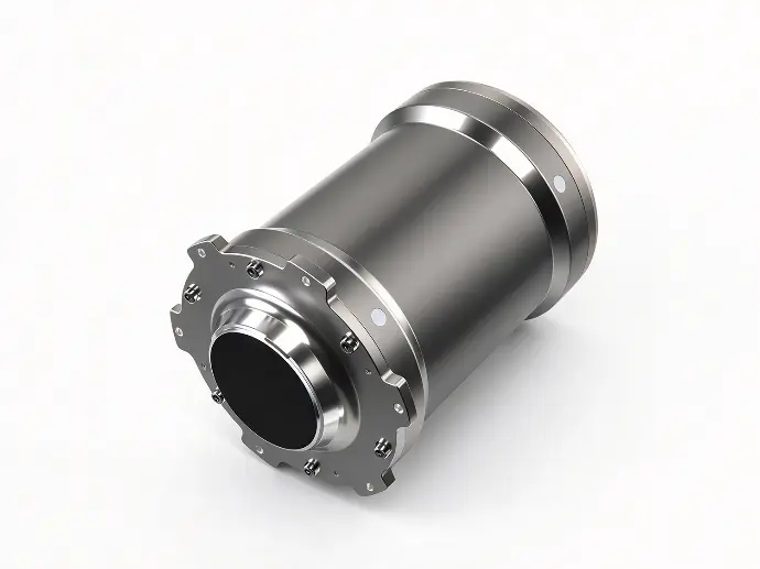
The UAL-AT2030-L1500 shows what a single beacon looks like: 1,500 m depth rating in a 460 mm titanium housing, 20–30 kHz, CW and LFM, at least 185 dB of source level at 25 kHz, omnidirectional horizontally and at least 180° vertically, depth measurement to 7.5 m accuracy, and 14 days of in-water standby plus at least 48 hours of continuous interrogation on a 77 Wh pack. Two-way ranging and an interrogation-response protocol mean the beacon only transmits when asked, which is what makes a year of standby possible.
INS and DVL: why 1% of distance is a big number
An inertial system measures acceleration and rotation, integrates them, and corrects the drift with a Doppler velocity log looking at the seabed. The NAVS-P600K combines INS, DVL, USBL and GNSS in one 180 mm housing under 8 kg, with static alignment in five minutes and dynamic alignment in fifteen.
Its headline accuracy is the one worth reading twice: 1% of distance travelled in the standard version, 0.5% in the professional version. One percent of 10 km is 100 m. A vehicle that runs a 10 km line and surfaces with a standard-grade INS/DVL will be 100 m from where it thinks it is, and no amount of post-processing recovers that without an external fix.
That is not a criticism of the instrument; it is the definition of dead reckoning. The DVL measures velocity to ±1% ±1 cm/s, the gyros and accelerometers measure attitude to a fraction of a degree, and the position is the integral of those measurements. Error accumulates because integration accumulates error. The professional grade halves it, which is why the licence tier exists: the difference between 100 m and 50 m after 10 km is a different mission plan, not a nicer datasheet.
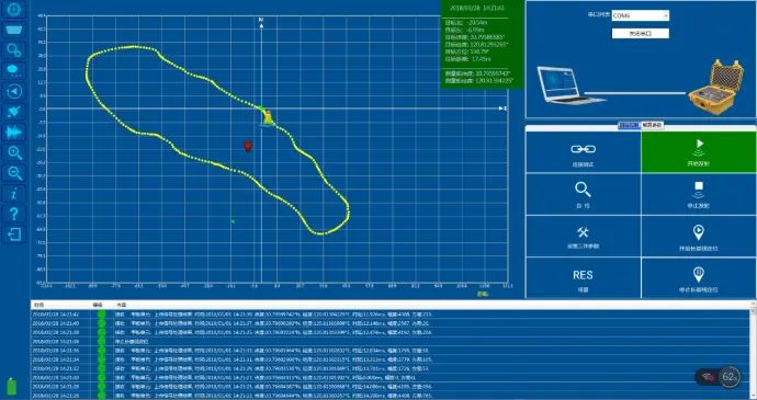
What closes the gap is aiding. GNSS at the surface, USBL near the work site, LBL over a fixed installation — each one resets the integral. A vehicle that starts with a GNSS fix, runs on INS/DVL between fixes and takes a USBL update at the target can hold metre-level accuracy over a long line, while the same vehicle without the updates drifts at the advertised percentage. The dead reckoning discussion is worth reading before specifying a mission profile.
The compact end of the range matters too. The NAVS-1000 fits in a 101 mm titanium housing at 2.5 kg in air with 1,000 m depth rating, gives 0.05° attitude and 0.25° × sec(latitude) heading, 0.5% of distance for straight-line navigation and 0.1% for survey lines, and draws 15 W for the INS and DVL together. The 300 m version is under 2 kg and tracks bottom from 0.2 m to 40 m altitude at ±9 m/s.
| Capability | USBL (P300) | LBL (medium / low) | INS/DVL (P600K STD / PRO) |
|---|---|---|---|
| Range | 300 m | 2,000 / 8,000 m | unlimited, error grows with distance |
| Stated accuracy | 1%D ± 0.3 m range, ±1.5° bearing | 3 m / 5 m | 1%D / 0.5%D |
| Error at full range | 3.3 m range, 7.9 m cross-track | 3 m / 5 m | 100 m after 10 km (STD) |
| Refresh | 4 s | interrogation cycle, adjustable | continuous |
| Targets | 5 | 5 | one vehicle |
| Infrastructure | none | seabed beacons | none |
| Fails when | long range, fast target | array geometry poor, beacons lost | no aiding, long lines |
The three systems on one table
Read the table across rather than down. The USBL row quotes accuracy at a distance, the LBL row needs installation, and the INS row carries error that depends on how far you have driven rather than on where you are. Those three properties, not the numbers, decide which system a mission can actually use.
Speed, latency and target count
Three operational limits sit outside the accuracy columns and cause most of the field complaints.
Speed. The USBL is rated to 3 knots of target motion. Beyond that the bearing estimate degrades faster than the range estimate, and the track starts to lag. A DP vessel holding station is the easy case; a chasing small boat is not.
Latency. Four seconds between fixes, adjustable interrogation periods on LBL, and the integration delay inside an INS all mean the displayed position refers to the recent past. For a vehicle under manual control this is invisible. For an autonomous controller closing a loop on the position, it is a stability parameter and has to be in the control design.
Target count. Five targets on both the USBL and the LBL set is a real ceiling, not a marketing round number. A dive operation tracking six divers needs two systems or a different scheme, and that should be discovered in planning rather than on deck.
Choosing by task
Tracking a diver or ROV around a vessel. USBL. No installation, 300 m of coverage, and a cross-track error that the operator can see and compensate. Add the integrated USBL and modem if voice or data to the diver matters, which is what the P300 combines.
Positioning a tool over a fixed site for weeks. LBL. Beacon positions surveyed once, accuracy independent of the vessel's wander, and a year of standby on the low-frequency set at a 6,000 m site.
AUV mission with no surface contact. INS/DVL, aided at the start and at any opportunity. Accept the percentage, plan the line so that the drift lands inside the survey corridor, and take a USBL or LBL fix when the vehicle returns to the work site.
DP operations next to a structure. LBL plus INS, with the USBL as a backup reference. Redundancy is the point: two independent acoustic references plus inertial continuity is a different risk profile from one of each.
Search and salvage. Start with USBL to find the contact, then fix it with LBL or a transponder for the lift. The accuracy needed for the search is metres; the accuracy needed for the lift rigging is decimetres, and they are not the same instrument.
Two arithmetic checks decide most specifications before any hardware is discussed. Multiply the bearing error by the range and compare it with the ranging error: if the cross-track term is several times larger, the system will be angle-limited and no amount of ranging improvement will help. Multiply the percentage by the mission length: if the result exceeds the survey corridor, the mission needs aiding, not a better gyro.
FAQ
Is USBL less accurate than LBL?
At short range the two are comparable; at long range USBL is angle-limited while LBL is not, because LBL derives position from ranges to fixed beacons rather than from a bearing measured at the vessel. The crossover in our catalogue is around 200–300 m, which is also where the USBL's rated range ends.
Why does my INS/DVL position drift even though the DVL is working?
Because the DVL measures velocity, not position, and small velocity errors integrate into large position errors. A 1% velocity error over 10 km is 100 m regardless of how well the DVL is tracking the bottom. Aiding fixes the integral, not the instrument.
Can one transponder serve both USBL and LBL?
Often yes. A beacon that supports interrogation-response and two-way ranging can be tracked by a vessel-mounted array and also ranged by a vehicle. The constraint is the frequency band and the protocol, so check that the transponder and the interrogating system share a band before assuming compatibility.
What depth rating should I specify?
Match it to the site with margin, then check the battery and housing material. Our beacon line spans 1,500 m in titanium at 2.3 kg in water up to 6,000 m low-frequency arrays, and the mass difference between a 1,500 m and a 6,000 m housing is the difference between a diver-carried beacon and a launch-and-forget one.
How many beacons does an LBL array need?
Four gives redundancy and a geometry check; three gives a fix with no redundancy; more improves robustness in a busy site. The pattern matters more than the count: beacons spread around the work area constrain the solution far better than a line of them, even with the same number.


USBL, LBL or INS-DVL: Choosing Underwater Positioning