A metre-long survey boat is a power budget with a hull around it. Every sensor you add draws a few watts; every knot you add draws hundreds, and the difference decides whether a day on the river is six kilometres or ten. This note works through the numbers on our USV-6S, compares it with the larger 8S platform, and sets out what each one can realistically carry on an inland survey.
What a small USV can actually carry
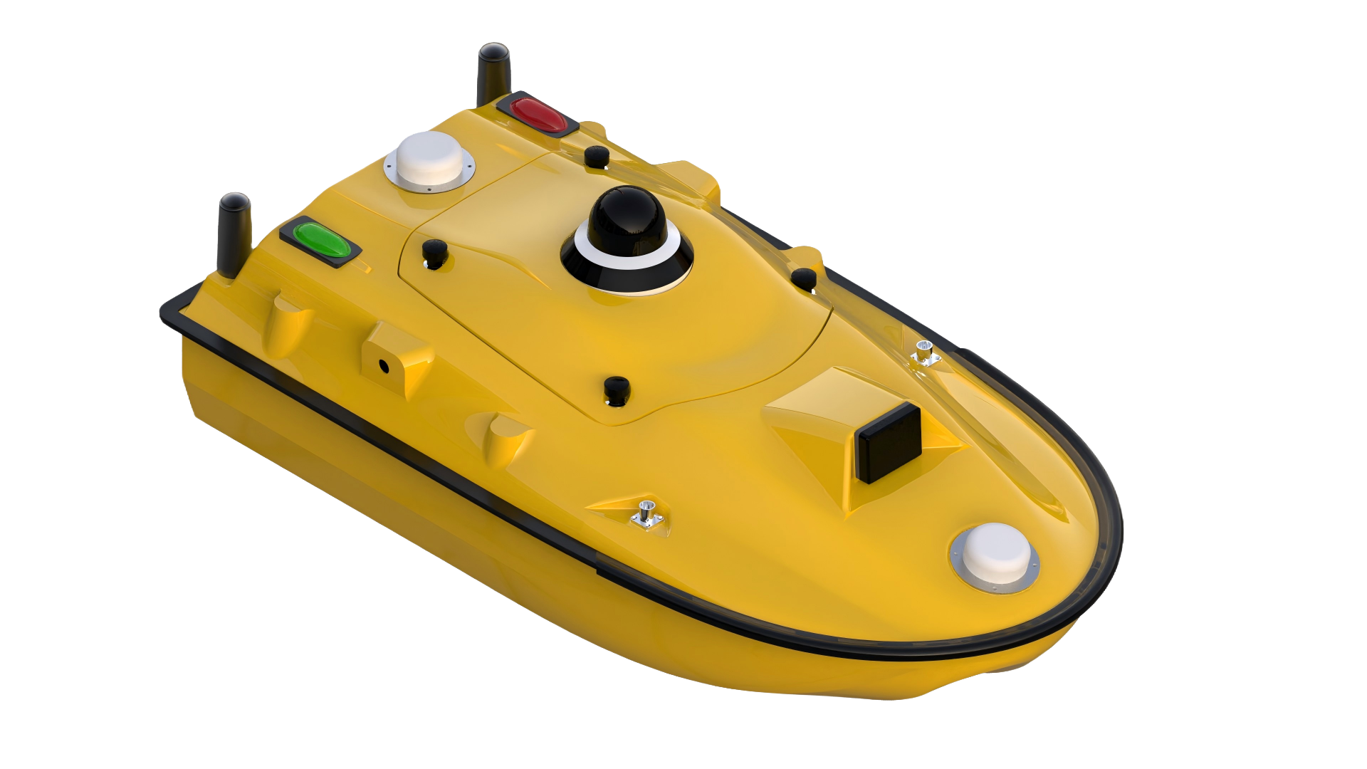
The 6S hull is 0.98 × 0.52 × 0.255 m, 7 kg bare, 20.4 kg without batteries and 27.8 kg with both packs. Maximum payload is 35 kg, draft 8.5 cm, wind resistance to level 3 and wave to level 2, IP67 throughout, with dual GNSS antennas for position and heading and a 360° night-visible camera on a gimbal.
Those figures are the whole design brief of an inland survey boat: light enough for one person to launch off a bank, stable enough for a 150 m side-scan swath, and sealed against spray rather than against breaking waves. A reservoir in the morning, a river reach in the afternoon, and a car boot in between.
The payload number deserves a second look, because 35 kg is not a small allowance for a hull this size and it is not all available at once.
The power budget: speed costs, sensors do not
The propulsion figures are the interesting part. A 900 W brushless motor, 5300 rpm, differential steering with reverse, driving a semi-embedded ducted thruster designed to shed weed. Two 33.6 V 25 Ah packs, each 840 Wh, so 1,680 Wh on board, hot-swappable and two hours to recharge.
Quoted endurance is 3 hours at 2 m/s and 7 hours at 1.5 m/s. Divide the energy by the time and the average draw falls out:
1,680 Wh / 3 h  = 560 W average at 2 m/s
1,680 Wh / 7 h  = 240 W average at 1.5 m/s
A 33% reduction in speed cuts the average power by 57%. Fit the exponent and you get about 2.9, which is what hull resistance theory predicts for a displacement hull near its hull speed: power roughly with the cube of velocity. The arithmetic is worth internalising because it inverts the usual intuition. Buying a bigger battery extends endurance linearly; slowing down extends it by a power law, and it is free.
The same arithmetic gives the number a survey plan needs, which is track length:
| Speed | Endurance | Survey line per charge |
|---|---|---|
| 2.0 m/s | 3 h | 6.0 km |
| 1.5 m/s | 7 h | 10.5 km |
Against that, the sensors are almost free. The TFSS-4510 triple-frequency side-scan draws under 20 W, the 200 kHz echosounder 5–10 W, and the flight controller and radios add a few watts more — call it 30 W against 560 W of propulsion, about 5% of the load. Doubling the sensor fit changes endurance by minutes; adding half a knot changes it by hours.
That asymmetry has a practical consequence for how you plan mobilisation. It is worth arguing about which sonar to fit and not worth arguing about whether the boat can carry it electrically. The compact side-scan family that the 6S ships with is a 208 × 39 × 32 mm package rated to 300 m, which is a reminder that the sonar is no longer the heavy part of a small survey payload.
Payload, draft and loading limits
Draft is where the numbers stop being comfortable. The waterplane is roughly 0.98 × 0.52 m, about 0.51 m². At the quoted 8.5 cm draft, the displaced volume is 0.043 m³, so about 43 kg of displacement — which covers the boat and its batteries, not the boat plus a full 35 kg payload.
That is an estimate on a simplified waterplane, and the M-shaped monohull is not a rectangular box, so treat 43 kg as the order of magnitude rather than the answer. The point stands: loading a 6S to its payload limit puts it visibly deeper than the bare-hull draft, and an operator who has only seen the boat empty should not assume the same freeboard. Two sensors, a battery swap and a wet hull all move the waterline.
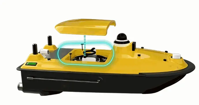
The 8S answers this differently. At 1.28 × 0.58 × 0.43 m with a 12 kg hull, 50 kg payload, 10 cm draft and a Φ30 cm moon pool, it is built for the case where the sensor set is the mission. A moon pool means a multibeam or an ADCP can look straight down through the hull without a pole over the side, which is the difference between a clean installation and one that drags.
Sensors that fit, and what each one measures
The 6S ships with a triple-frequency side-scan and a single-beam echosounder, and the pairing is deliberate: one instrument images the bottom sideways, the other measures depth under the boat.
The echosounder is 200 kHz with an 8° beam, 0.15–200 m range, 8 mm resolution and ±1 cm + 0.1% of depth accuracy. An 8° beam footprint is about 0.14 × depth, so 1.4 m at 10 m and 14 m at 100 m. At 100 m the accuracy term is ±11 cm. That is a spot depth per ping, not an image, and it is exactly what a check line needs.
The side-scan runs 450, 800 and 1000 kHz with 1.0° × 60°, 0.55° × 35° and 0.4° × 60° beams, reaching 150, 75 and 45 m per channel with up to 3 mm of range resolution. On a 1 m boat that is a swath several hundred times the hull width, which is the whole reason a small USV makes sense for inland work: the boat does not need to be big, the sonar does not need to be big, and the coverage is still there.
Add an ADCP and the boat measures velocity as well as depth; add a sub-bottom profiler and it sees through the bed; add a water-quality sonde and a single mission produces three datasets. The 6S supports the first two through its expansion port and payload allowance; the 8S supports all of them through the moon pool. Two RJ45, two RS232 and two RS485 ports on the flight computer are what makes this practical, because every sonar in this class wants either Ethernet or serial and rarely the same one.
Position and heading on a one-metre hull
RTK is what makes a small USV a survey platform rather than a remote-controlled boat. The 6S quotes ±8 mm + 1 ppm horizontal and ±15 mm + 1 ppm vertical, with NTRIP client support and a UHF base station option, and a single-point fallback at 1.5 m horizontal. Between those two modes is the difference between a bathymetric chart and a sketch.
Heading comes from the dual antenna baseline, quoted 0.1° at a 1 m baseline. On a 0.98 m hull the baseline is necessarily short, which is why two antennas are fitted rather than one: a single antenna gives position but not orientation, and orientation matters because the side-scan swath is referenced to the boat's track. A 0.1° heading error over a 150 m swath displaces the outer edge by 26 cm, which is well inside the 3 mm range resolution but not inside the along-track positioning of a harbour chart.
The IMU runs at 200 Hz, which is what lets the software compensate for roll and pitch on a boat that weighs under 30 kg and responds to every ripple. Attitude correction is in the processing chain, not an afterthought, because a 8.5 cm draft boat in a level 2 wave rolls more than a ship does.
Control link and the failure modes
Control is 2.4 GHz to 3 km, or effectively unlimited over 4G with a SIM, and the spec is honest about the split: line-of-sight radio has a range and cellular does not, but cellular has coverage gaps that a river bend will find. The safe pattern is to plan the mission around the radio link and treat cellular as the extension.
The safety features read like a list of everything that has gone wrong on someone else's boat: obstacle detection at 0.1–20 m across a 120° × 120° field of view, shallow-water alert, speed anomaly alert, low battery and signal loss alert, payload malfunction alert, auto-return and breakpoint continuation. At 7 m/s a 0.98 m boat covers 7 m in a second, which is why the avoidance cone reaches 20 m and why the alert stack exists.
The 8S extends the envelope to level 4 wind and level 3 wave with 50 kg of payload, which is the point where an inland boat becomes a nearshore boat. It also becomes a boat that needs a two-person crew and a vehicle with a ramp, which is a different operational cost.
Two platforms, two missions
Choose the 6S when the job is a river reach, a reservoir, a canal or a dam face, the sensor set is one side-scan and one echosounder, and one person with a car needs to be on the water within twenty minutes. Its limits are draft under load, a short antenna baseline, and a sea state that stops at level 2.
Choose the 8S when the job needs a moon pool, several sensors looking down at once, and the site is nearshore with level 3 waves. Its cost is mass: 12 kg of hull before payload, a bigger battery set, and a launch method that involves more than one person.
Choose neither, and take a Wave Glider instead, when the mission is months of persistence rather than a day of survey. A solar wave-propelled vehicle has no endurance figure to argue about, and no speed either — which is the trade this whole power budget is about.
The arithmetic at the top of this note applies to all three. Endurance is set by speed, coverage is set by the sensor, and the hull only has to be big enough to float both.
FAQ
Why does slowing down extend endurance so much?
Because propulsion power scales roughly with the cube of speed for a displacement hull. Dropping from 2 m/s to 1.5 m/s cuts the average draw from about 560 W to about 240 W on the same pack, which turns a three-hour mission into a seven-hour one.
Can I run the side-scan and the echosounder at the same time?
Yes. Together they draw under 30 W, about 5% of the propulsion load, so there is no electrical reason to alternate. Interference between a 200 kHz echosounder and a 450 kHz side-scan is the real constraint, and in practice they are separated in frequency enough to run concurrently.
How much weight can I really add before the boat sits too low?
The bare-hull draft quoted at 8.5 cm corresponds to roughly 43 kg of displacement on a simplified waterplane, while the boat with both batteries already weighs 27.8 kg. A full 35 kg payload therefore needs a deeper waterline than the bare-hull figure suggests, so check freeboard with the actual load rather than trusting the empty-boat number.
Is RTK necessary for a side-scan survey?
It depends on the product. For a chart-grid survey, RTK at ±8 mm horizontal is what makes the imagery mappable to a fixed reference; single-point at 1.5 m is enough to know which reach you surveyed. The sonar resolution is not the limiting factor in either case — the position is.
What happens when the radio link drops?
The boat continues on its planned route, holds the mission state, and returns to the last good waypoint or to the launch point depending on the configured behaviour. Breakpoint continuation means a re-established link resumes rather than restarts, which matters on a 10 km line where a restart costs an hour.

Survey USV Payload and Power: What Fits on a 1 m Hull