Home | Dive & Underwater Equipment | DS-Commander-Map
DS-Commander-Map
Control Center Map Series
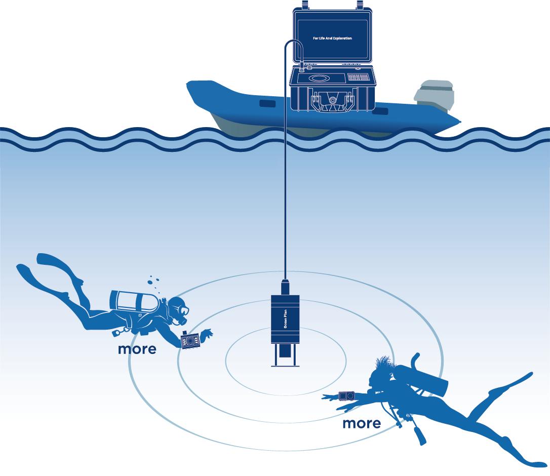
The DS-Commander-Map is the central component of our integrated underwater communication and navigation solution. It seamlessly merges core acoustic positioning, navigation, and wireless communication with high-precision satellite data, creating a unified operational picture for surface commanders.
Engineered to excel in professional environments, the system is designed to support mission-critical scenarios, including scientific research, search and rescue (SAR), salvage operations, and advanced diver training. It delivers a comprehensive suite of practical features—such as underwater target point setting, real-time trajectory recording, and map-based fleet management. By allowing for the easy export of detailed dive records, the DS-Commander-Map streamlines the entire operational workflow, from pre-mission planning to post-mission analysis, ensuring the success of complex underwater activities.
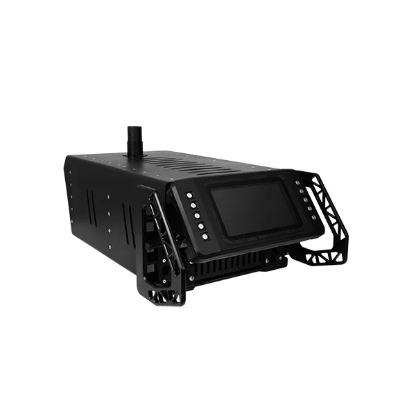
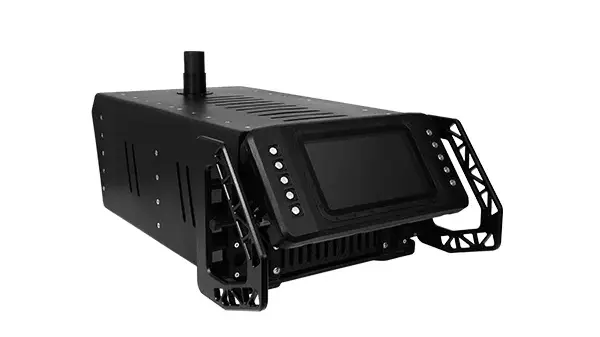
DS-Commander-Map
Key Features
- Target & Route Planning Supports 1,500 target points and planned route creation for precise navigation.
- 3D Navigation & Tracking Tracks real-time movement, depth, and coordinates, displaying trajectory lines for accurate guidance.
- Multi-Mode Mapping Offers Standard, Satellite, Coordinate, and Imported maps to suit various operational needs.
- Safety Warnings & SOS Monitors depth, speed, and distance thresholds, with an emergency SOS button for team alerts.
- Data Logging & Messaging Logs complete dive records for export and provides 30 pre-set text messages for team communication.
Components of MAP Series
The MAP Series is built on a modular, multi-component architecture designed to provide a complete operational picture from the surface to the deep. The system consists of the following professional-grade units:
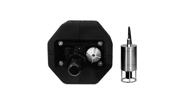
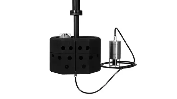
1. Control Center: DS-Commander-Map The central command and monitoring hub, which includes:
- Surface Command and Control Unit: A high-performance interface for real-time mission management, trajectory tracking, and map-based coordination.
- Positioning and Communication Buoy: A critical link that bridges satellite data with underwater acoustic signals, ensuring precise spatial referencing for the entire team.
2. Dive Navigation Computer: DS-Navygator-Map A specialized, arm-worn navigation terminal for individual divers. It brings full map visualization and real-time positioning directly to the diver's wrist, allowing for autonomous navigation and seamless communication within the system network.
Specifications
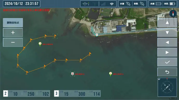
Underwater Target Point Setting
The underwater mapping series allows divers and commanders to set target points using either map-based locations or precise latitude and longitude coordinates.
- High-Capacity Management: The system is capable of managing and storing up to 1,500 individual target points.
- Route Planning: Multiple target points can be combined into pre-planned routes, providing a structured framework for accurate positioning and navigation during complex missions.
Underwater Trajectory Recording
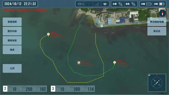
The system tracks diver movements in real-time, meticulously recording data such as timestamps, depth, and spatial coordinates. This data is visualized as trajectory lines on a map interface, providing a comprehensive historical record that facilitates the analysis and management of underwater activities.
Underwater 3D Navigation
Divers receive continuous, real-time navigational data, including the depth, distance, direction, and precise coordinates of target team members or pre-set points. this 3D spatial guidance ensures that every diver reaches their destination with absolute precision.
Map Mode Management
To adapt to diverse operational environments, the system offers four distinct viewing modes: Standard Map, Satellite Map, Coordinate Map, and Imported Map. Users can flexibly switch between these modes to match their specific situational needs.
Dive Record and Export
The system automatically logs all critical dive data in real-time, including time, depth, movement trajectories, abnormal status warnings, SOS alerts, and communication logs. This data can be easily exported for post-mission reporting and long-term record-keeping.
SOS Emergency Alarm
Every diver terminal is equipped with a dedicated, independent SOS button. In an emergency, a diver can instantly broadcast an alert to all networked team members and surface personnel, ensuring an immediate and coordinated rescue response.
Abnormal State Warnings
The system proactively monitors diver movements and supports configurable safety thresholds for key parameters, including:
- Ascent and Descent Speeds
- Safe Separation Distance
- Maximum Operational Depth
If any threshold is exceeded, the system automatically issues a warning to the team, effectively preventing potential risks before they escalate.
Text Message Communication
To enhance coordination efficiency, the system includes 30 pre-set text messages. This allows for quick and reliable communication between networked team members, replacing limited hand signals with clear, actionable information.
Core Application Scenarios
- Search and Rescue (SAR) & Salvage Operations
Surface commanders plan grid search routes with up to 1,500 target points and track divers' real-time 3D locations up to 1,500m. Divers can quickly mark targets, communicate via text, and trigger instant SOS alerts during emergencies. - Scientific Research & Underwater Archaeology
Combines RTK satellite and underwater acoustic positioning to accurately mark sample and artifact locations. Supports importing custom seabed maps and automatically logs full 3D trajectory data for post-expedition analysis. - Infrastructure & Dam Inspection
Overlays CAD/GIS engineering maps for precise navigation around dams, ports, and pipelines. Uses 30 pre-set text messages for quick underwater defect reporting and sets safe distance thresholds to prevent diver hazards. - Advanced Diver Training & Fleet Management
Monitors multi-diver formations, depth, and movement in real time from the surface. Complete dive records and 3D trajectory playbacks enable detailed post-mission debriefs and data-driven performance evaluations.