Home | USV Series | Uscan-USV-6S
Uscan-USV-6S
Only Seeing is Reassuring
The Portable Hydrography Survey Unmanned Surface Vehicle (USV) for Rivers, Lakes & Reservoirs
The Uscan-USV-6S is an ultra-compact hydrographic survey USV engineered for rivers, lakes, and reservoirs. Equipped with a tri-frequency side-scan sonar and echosounder, it delivers simultaneous bathymetric profiling and high-resolution underwater imaging. Portable enough to fit in an SUV trunk for single-person rapid deployment. As a 1-meter surface platform coming standard with the TFSS-4510 Tri-Frequency Side-Scan Sonar, it seamlessly synchronizes high-resolution underwater imaging with precise bathymetry.

Uscan-USV-6S Unmanned Surface Vehicle
Key Features:
- Tri-Frequency Total Scan: Standard with TFSS-4510 Tri-Frequency Side-Scan & Bottom-Scan Sonar and 200KHz single-beam echosounder; delivers synchronized depth profiling and high-resolution bottom imaging in a single pass.
- Inland Water Optimization: 0.98m M-shape Carbon Fiber & Kevlar hull with semi-embedded ducted thrusters; engineered for weed-resistance and high stability in rivers, lakes, and reservoirs.
- Single-Person Portability: Hull weight is 7.0 kg (empty) / 20.4 kg (standard configuration, excluding batteries); fits into standard SUV trunks for rapid single-person deployment and launch.
- Automated Fail-Safe Flight: Powered by iSail software for autonomous route planning and automatic obstacle avoidance (0.1–20m range); features auto-return on low battery, signal loss, or shallow water.
- Modular Sensor Expansion: Open SDK with standard interfaces ( 2×RJ45; 2×RS232; 2×RS485); supports optional hardware integration of water quality sensors, spectrometers, gas detectors, and acoustic alarms.
-
Night Vision Equipped: Fitted with night-vision cameras to ensure continuous round-the-clock visual observation and field operation in low-light or nighttime environments.
Overview
Scan Gallary
TFSS-4510 Triple-Frequency Scanning Sonar Imaging Example
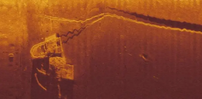 boats (1000kHz)
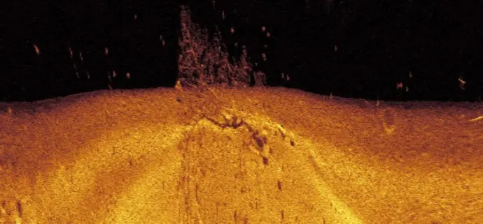 Underwater tree and bait fish (1000kHz)
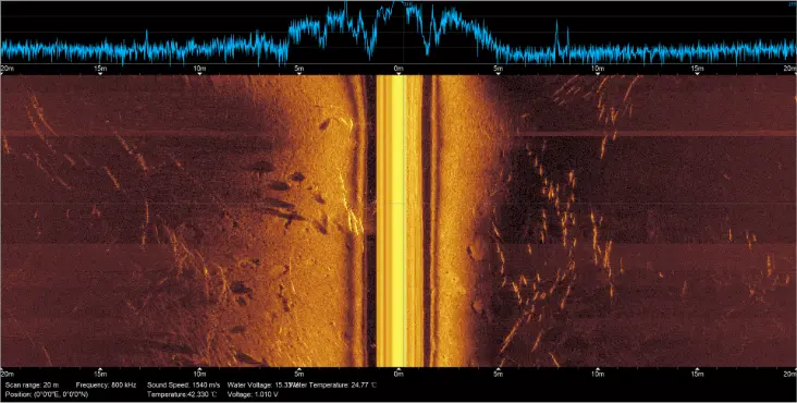 Fish
school (800kHz)
Fish
school (800kHz)
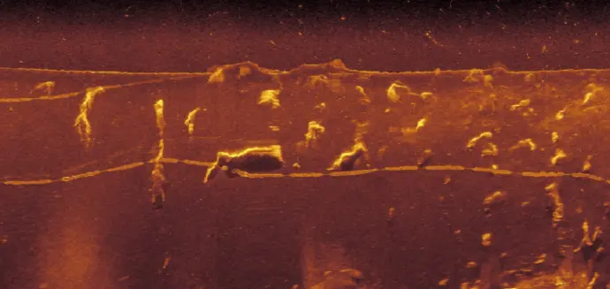 Shrimp traps (450kHz)
Specifications
Application
-
Hydrographic & 2.5D Underwater Topographic Mapping
Inland river & reservoir bathymetry, river channel cross-section survey, 2.5D underwater topographic scanning, submerged terrain visualization - Underwater Infrastructure & Dam Inspection
High-resolution side-scan sonar imaging for inspecting reservoir dams, bridge piers, underwater foundations, and embankment scour profiling. - Hydrological Survey & Emergency Search
Rapid-response underwater object detection, drowning rescue support, debris location, and cross-sectional flow field auxiliary surveying. - Environmental & Water Quality Monitoring
Mobile multi-parameter water quality profiling and spatial distribution mapping via optional integrated sensors and automated route sampling. - Underwater Asset & Pipeline Inspection
Factual acoustic scanning and condition monitoring for submerged pipelines, cable crossings, intake structures, and underwater archaeological sites.
Safety & Automatic Return Functions
- Low-Battery Return
- Tracking Return
- Auto Backing
- Disconnected Return
- Obstacle Avoidance
USV Structure & Component Diagram
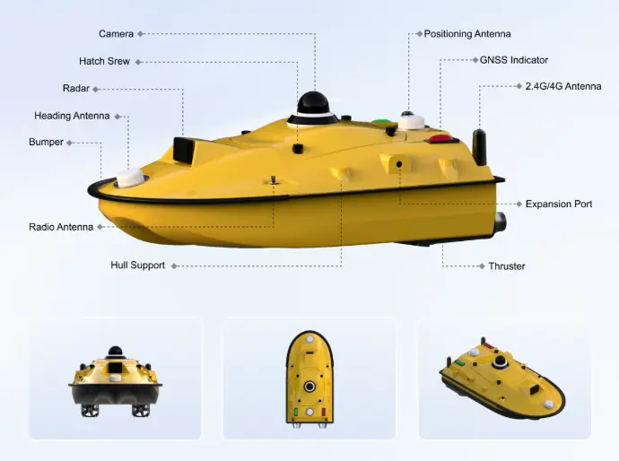
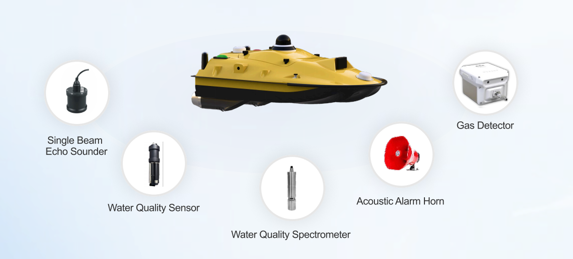
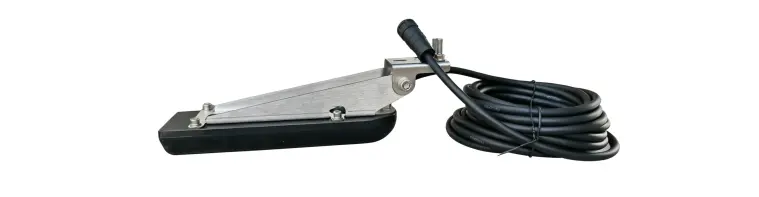
Equipped with TFSS-4510 Tri-Frequency Side-Scan Sonar with Bottom-Scan Functions
Video Showcase
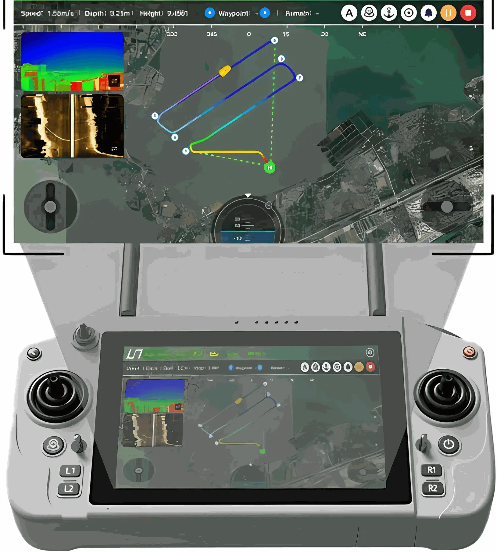
iSail Software & U-Controller Handheld Terminal
iSail: Intelligent Control for USV Operations
iSail is an advanced Android-based software for controlling our USV and post-processing data. It processes operational commands and sensor data, executes control algorithms, and drives the USV to perform corresponding actions.
U-Controller: Professional USV Controller
- Sunlight-Readable 12" Touchscreen
- 2h Fast Charge for 8h Work Hours
- Quick Buttons for Key Functions