Home > AUV Communication & Navigation Kit
> NAVS-MS300DK
NAVS-MS300DK
Compact Navigator
Surface & Underwater Navigation Position System
High-performance INS/DVL integrated navigation system for AUV, ROV and marine engineering vessels
The NAVS‑300 surface and underwater navigation positioning system integrates Inertial Navigation System (INS) and Doppler Velocity Log (DVL) with an all‑in‑one compact design. It can measure heading, attitude, velocity and position information of underwater moving carriers in real‑time with high accuracy. The unit is compatible with most AUVs, ROVs and marine engineering vessels.
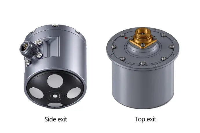
NAVS-MS300DK Navigation Position System
Key Features:
- Autonomous dynamic north-seeking, underwater navigation, fully autonomous and all-weather operation
- Integrated compact design featuring low power consumption, small footprint and competitive cost
- Dedicated Kalman filter deeply fuses data from INS, DVL, USBL and GNSS, delivering high precision and excellent system stability
Key Features
Specifications
Applications
Marine Resource Exploration
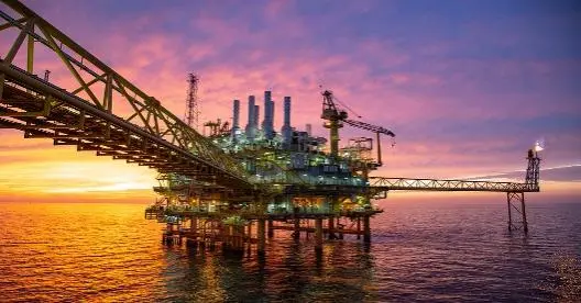
The offshore oil and gas energy industry relies heavily on marine and underwater technologies. Through high‑precision seabed survey and geological research, the system enables accurate location of gas and oil fields, rig installation, pipeline laying and port facility construction. Continuous inspection and preventive maintenance can be carried out for energy platform mooring equipment, subsea infrastructures and pipelines.
Underwater Engineering Operations
This high‑precision navigation positioning system supports integration with various subsea auxiliary sensors such as GNSS and USBL to achieve higher positioning accuracy over longer distances. It is suitable for search, rescue and salvage tasks in diverse water environments including seas, rivers and lakes, providing a fast, efficient and safe solution for underwater rescue‑and‑salvage missions.
ROV / AUV / DPV Navigation
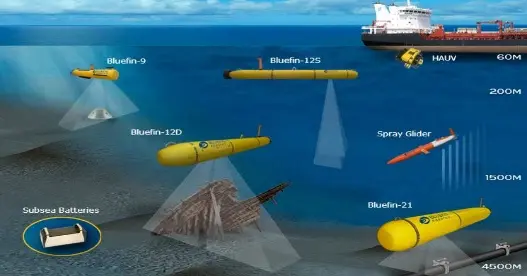
High‑precision navigation positioning technology allows unmanned underwater platforms to rapidly intervene and complete missions effectively. It can execute various tasks quickly and accurately. As we enter a new era of data acquisition and surveying, this advanced navigation system greatly simplifies seabed investigation, inspection and data collection, and minimizes impacts on marine hydrological environments.

FAQ Frequently Asked Questions
The Q&A below refers to specifications of the Standard Version (License‑Required). For specifications of other versions, please refer to the technical datasheet or contact us.
The standard version is rated for 300 m. Custom higher‑depth versions are available. Please send your project parameters for technical evaluation.
Underwater positioning relies on INS+DVL integrated navigation without GNSS. Position drift is less than 0.5%D at speed ≤15 knots when DVL maintains bottom‑lock. GNSS can correct position on surface, and USBL can be connected for auxiliary underwater positioning.
Bottom‑track performance will degrade in heavy silt or dense weeds. If DVL bottom‑lock fails, the system runs on pure INS with increased position drift. USBL is recommended as auxiliary positioning under such conditions.
Standard interfaces: RS422 / RS232, data output rate configurable 1‑200Hz. It supports standard navigation protocols and is compatible with most ROV / AUV controllers. Custom protocol development is supported on request.
Standard static alignment ≤5 min, dynamic alignment ≤15 min. Contact our engineering team for special fast‑alignment solutions.
Total power consumption is less than 10 W. Low power draw makes it well suited for battery‑operated AUVs and compact ROVs.
Explore the ADCP Series
The China-Sonar ADCP Series covers the full spectrum of applications from shallow rivers to the deep ocean. With models including the ADCP-1200K, ADCP-600K, and ADCP-300K, the series is tailored for river discharge monitoring, coastal and offshore surveys, and deep-sea research & engineering.