An AUV datasheet lists range in kilometres and endurance in hours on separate lines, and the two only make sense together when you divide one by the other. That division is where most mission plans go wrong, because a 400 km range at 150 hours implies a speed the vehicle may not have. This note walks through the AUV-HJ series numbers the way a survey plan should: range against speed, payload against buoyancy, sensor against altitude, and navigation against the absence of GNSS.
What an AUV mission actually specifies
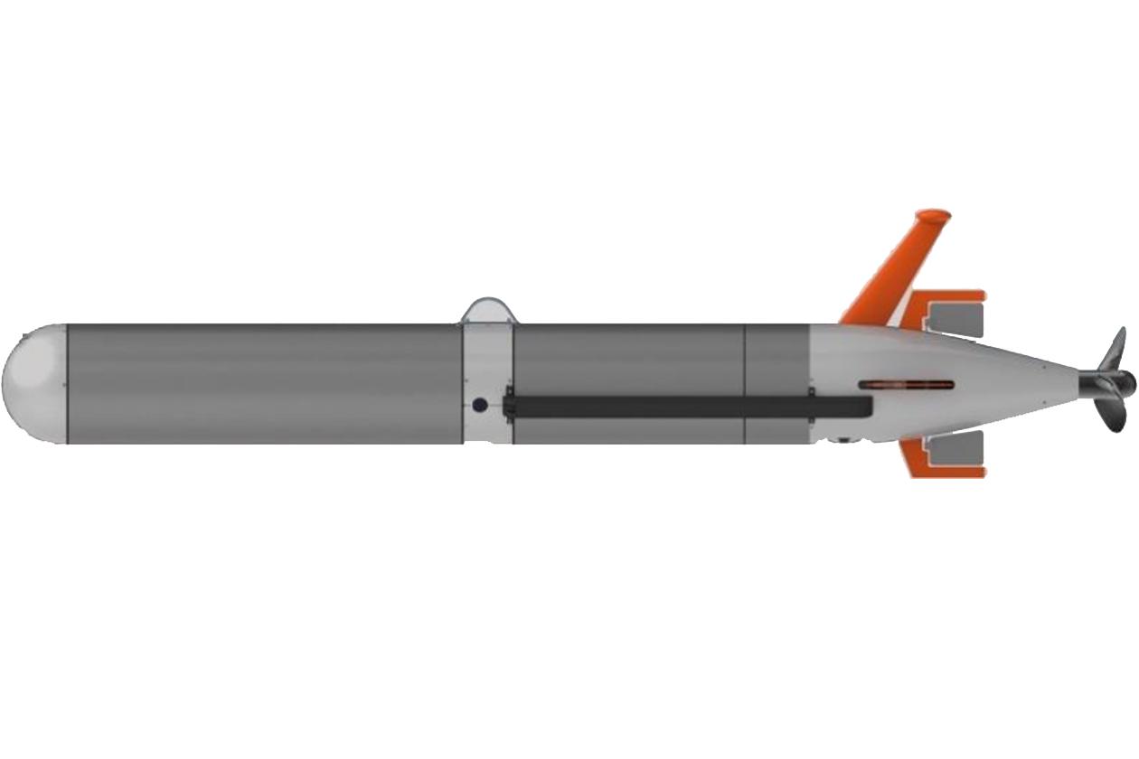
Four numbers define an AUV job: how far, how deep, how fast, and what it carries. The HJ300M is 300 mm in diameter, 2 to 3 m long, 80–300 kg depending on payload, rated to 300 m, with 24–60 hours of endurance, a 360 km maximum range, and 0–4 knots of speed. The HJ1000M is 350 mm × 3.5 m, 300 kg, rated to 1,000 m, with 0–3 knots and a 400 km maximum range.
Everything else in the datasheet — DVL model, side-scan frequency, attitude sensor, communications stack — is a consequence of those four. A vehicle that has to hover needs buoyancy control; a vehicle that has to fly at 45 m altitude needs a DVL that tracks that high; a vehicle that has to report from under ice needs acoustic comms rather than cellular.
The trap is quoting the four independently. They are not independent.
Range and endurance only mean something at a stated speed
Take the HJ300M: 360 km of maximum range and 24–60 hours of endurance. Divide and you get the implied speed, and the answer varies by a factor of 2.5:
| Assumed endurance | Implied speed for 360 km | Within the 0–4 kn envelope? |
|---|---|---|
| 24 h | 4.17 m/s = 8.1 kn | no, above the 4 kn maximum |
| 40 h | 2.50 m/s = 4.9 kn | no |
| 60 h | 1.67 m/s = 3.2 kn | yes |
Read the other way: at the 4 kn maximum, which is 2.06 m/s, a 24-hour mission covers 178 km, not 360. The 360 km figure is therefore a statement about the long end of the endurance band, at a cruise of about 3 knots, and any plan that assumes 360 km in a day is planning a different vehicle.
Now the HJ1000M: 400 km and 150 hours at 3 knots. Three knots is 1.54 m/s, so 150 hours gives 231 km, not 400. To cover 400 km in 150 hours the vehicle would need 2.67 m/s, which is above its quoted 3 knot ceiling. The series page and the product page also disagree on endurance — one line reads 72 h at 3 knots, the other 150 h. All three figures cannot be true at once.
This is not a criticism of one catalogue. It is the normal state of AUV datasheets, and it is why the specification conversation should end with a sentence like "at 3 knots, with this sensor set, at this water temperature, the vehicle does 230 km", and not with a range figure. Ask for the endurance at the cruise speed you intend to fly, and for the hotel load of the sensor set you intend to carry, and the arithmetic reconciles itself.
The practical version of the rule: range is endurance multiplied by speed, and endurance depends on hotel load, which depends on payload. Change the payload and both numbers move.
Payload: one hull, three hundred kilos of options
The HJ300M is quoted at 80–300 kg, which is a 220 kg spread on a 300 mm hull. That spread is the payload allowance expressed as displacement: ballast, batteries, and sensors trade against each other, and buoyancy control absorbs the difference so the vehicle can still hover.
Hovering is the capability that makes the spread useful. A flying AUV — one that runs a fixed depth with slight positive buoyancy and a propeller — can carry sensors but cannot stop. A hovering AUV with a precision buoyancy system can hold position at any depth, which is what a photogrammetry pass, a water-column station or a tool placement needs. The HJ300M lists constant-depth cruising, constant-altitude cruising, depth-hold hovering and sawtooth profiling as four distinct modes, and that list is the real payload specification: each mode demands different ballast authority.
Sawtooth profiling is worth explaining because it is the mode most often mis-specified. The vehicle climbs and dives through the water column in a zigzag, measuring on both legs, which produces a vertical section rather than a line on the seabed. For an ADCP or a CTD that is the useful geometry, and it costs depth rate rather than horizontal speed. The ADCP-on-AUV application note covers why the profiler and the vehicle have to be matched in power and size, and it applies equally to the 300 mm and 350 mm hulls.
Sensors: DVL, side-scan and the altitude that couples them
The standard fit on both vehicles is a Doppler velocity log, a side-scan sonar and a depth-altitude gauge, plus an attitude reference. The HJ300M carries a DeepNavi-S500 DVL; the HJ1000M a Nortek DVL1000. Both carry an ES4590 side-scan at 450 kHz and 900 kHz, reaching 150 m and 75 m per side, and both use an XSENS MTi-630 for attitude.
The altitude range of the DVL is the number that couples the sensor set together. The navigation kit quotes 0.05–45 m of bottom tracking. Fly lower than 5 m and the side-scan swath is narrow and the vehicle risks the bottom; fly at 45 m and the DVL is at its limit and the side-scan is looking through a long slant range. The useful survey band is therefore roughly 10–40 m of altitude, and the line spacing follows the swath at that altitude, not the swath at the datasheet's best case.
This is the same coupling that governs any side-scan installation: range resolution is set by bandwidth, but the across-track footprint is set by range and beamwidth. A 450 kHz sonar at 150 m has a footprint measured in metres, and no amount of 3 mm range resolution changes that. The phased-array DVL family exists in the same logic — a smaller, higher-frequency array buys altitude performance at the cost of range.
Navigation without GNSS
An AUV spends its working life with no satellite fix, so the navigation stack is dead reckoning plus whatever acoustic aid the mission can afford. Both vehicles list a fibre-optic gyro INS with DVL as the primary, a compass with DVL as the low-power fallback, and SSBL or LBL beacons as options.
That hierarchy is exactly the one from the positioning note: the INS integrates and drifts at a percentage of distance, the DVL keeps the drift honest by measuring velocity over ground, and the acoustic beacon resets the integral when the mission passes near one. On a 230 km mission, 1% of distance is 2.3 km, which is why an AUV survey is planned with a start fix, a mid-mission fix if a beacon is available, and a surfacing fix at the end.
The low-power mode matters for the endurance arithmetic. A compass and DVL pair draws a fraction of a FOG INS, and switching to it on a long transit leg is how a vehicle reaches the far end of its endurance band. That is the hotel load term in the range equation, and it is the one an operator can actually control during a mission.
Communications: surface, acoustic and the gap between them
Both vehicles carry an unusually wide communications stack: UHF wireless, BeiDou short message and Tiantong satellite, high-frequency acoustic communication, 4G and WiFi. Each one covers a different regime, and the gaps between them are where missions fail.
WiFi and 4G work at the surface and within cellular coverage. UHF works line-of-sight at the surface. BeiDou SMS and Tiantong work anywhere with a sky view, at low bandwidth and per-message cost. Acoustic works underwater, at 3, 10 or 30 km depending on band, with bandwidth that falls as range rises.
The transition from acoustic to satellite is the awkward part. A vehicle at 40 m depth, 8 km from the boat, is inside the 10 km acoustic band and outside every radio band. It can be commanded acoustically and it cannot send a photograph. A mission plan that expects daily imagery from a submerged vehicle is planning for a different vehicle; one that expects a position and a status word every few hours is planning correctly.
The navigation and communications kit packages this stack for GNSS-denied work, and its depth sensor figures — 0.1 m accuracy with 5 mm resolution — are worth noting because they set the vertical reference for everything else. A 5 mm depth resolution on a hovering vehicle is what makes a photogrammetric pass repeatable.
Hovering, sawtooth and the flight mode
Four operating modes appear on both datasheets, and they are not marketing categories:
- Constant-depth cruising is the transit and mapping mode; the vehicle holds a depth and the seabed varies beneath it.
- Constant-altitude cruising holds a height above the bottom using the DVL, which is the mode that keeps the side-scan at a fixed slant range and therefore a fixed footprint.
- Depth-hold hovering stops the vehicle in the water column, for a station measurement or an inspection.
- Sawtooth profiling climbs and dives repeatedly, producing a vertical section.
The choice between the first two is the single most consequential mission decision, because it trades image quality against bottom risk. Constant altitude gives a uniform swath; constant depth gives a varying one and, in shallow water, a risk of contact. A survey plan that names the mode, the altitude and the line spacing is a plan; one that names a range in kilometres is a hope.

FAQ
Why do the range and endurance figures not multiply out?
Because range is quoted at an optimal cruise speed and endurance at a low one. Multiplying the two published numbers gives an implied speed that may exceed the vehicle's maximum, which is why the arithmetic has to be done before the mission, not after. Ask for endurance at your intended cruise speed with your intended payload.
How much payload can the HJ300M carry?
The quoted 80–300 kg is displacement across configurations rather than a single payload allowance, and the difference between the two ends is ballast, batteries and sensors. The practical payload is whatever remains after the energy needed for the mission is accounted for, which is why the sensor hotel load belongs in the same conversation as the range.
What altitude should an AUV fly for side-scan?
Between roughly 10 and 40 m, inside the DVL's 0.05–45 m bottom-tracking band with margin at both ends. Lower gives a narrower swath and more bottom risk; higher pushes the DVL to its limit and lengthens the slant range. The swath at the chosen altitude sets the line spacing.
Can the vehicle be tracked acoustically while submerged?
Yes, at 3, 10 or 30 km depending on the acoustic band, or by an SSBL or LBL beacon where a fixed reference is installed. What acoustic tracking cannot deliver is high-bandwidth data — the range that reaches the boat is bought with bandwidth, so plan for position and status rather than imagery.
Is a fibre-optic gyro necessary on a 300 m vehicle?
It is the difference between a mission that can be re-planned in the water and one that cannot. A FOG INS with DVL holds heading far better than a compass over a long transit, at a power cost that shows up directly in endurance. The low-power compass mode exists for the legs where the drift budget allows it.

AUV Range, Endurance and Payload: Reading the Numbers