Home | DVL Series | DVL-300K
DVL-300K
Piston-type 4-Beam Doppler Velocity Log 300kHz
The DVL‑300K Doppler Velocity Log measures high‑precision motion velocity of the platform relative to the seabed. When integrated with a gyrocompass or inertial navigation system (INS), it forms an autonomous navigation system for control and high‑accuracy navigation of surface vessels, underwater tow‑bodies, AUVs and UUVs.
Tailored for medium‑to‑large‑size underwater platforms, it excels in missions requiring high stand‑off altitude, deep‑water operation, long‑range cruise and challenging seabed conditions. It maintains stable bottom‑lock performance even over complex bottom substrates during long‑distance voyages.
The device supports an optional current‑profiling function to measure flow‑field profiles in the surrounding area. It enables underway observation along the carrier’s navigation track, as well as fixed‑point flow‑field observation deployed on submersible moorings and buoys.
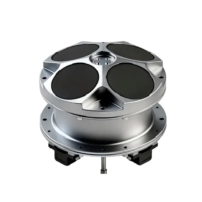
DVL-300K Doppler Velocity Log
Key Features
- 4‑beam Janus configuration for stable bottom‑tracking velocity measurement
- Max bottom‑tracking altitude: 250 m, suitable for large off‑bottom cruising height
- Supports underway & fixed‑mooring current profile observation (open ADCP function)
- Multiple industrial interfaces: Ethernet, RS232, RS422, RS485; PD6 & custom data format
- Titanium alloy housing; multiple depth‑rating options: 100 m (standard), 300 m /1000 m /3000 m (optional)
- Dual accuracy grades: export‑controlled high‑accuracy version and license‑free general‑purpose version
- Average power consumption only 8 W; works for both moving vehicle navigation and fixed‑point buoy / subsurface mooring deployment
Overview
Specifications
Application Scenarios
Core advantage: large maximum bottom‑tracking altitude, maintains bottom‑lock when vehicle flies high above seabed.
- Large‑size AUV & Work‑class ROV long‑range cruise Ideal for missions where vehicle operates frequently above 100 m altitude over seabed. Avoid frequent bottom‑lock dropout that forces fallback to water‑track navigation.
- Underwater tow‑body navigation & survey Towed survey platforms often keep large off‑bottom height; DVL‑300K provides stable velocity aiding for post‑processing mapping data.
- Oceanographic observation: buoy, subsurface mooring station Enable fixed‑point current profile measurement when ADCP function is activated. Supports long‑term moored deployment.
- Surface vessel underway current profiling Mounted on surface craft for underway water‑column flow observation.
- Subsea pipeline wide‑area preliminary survey Long‑distance cruising survey in continental shelf zone with variable off‑bottom height.
Not recommended: close‑range near‑seabed fine inspection under 1 m altitude (minimum blanking altitude is 100 cm). For near‑bottom fine operation, check our DVL‑600K 4‑beam DVL.
Working Principle
This 4‑beam DVL applies acoustic Doppler‑shift effect. Four tilted acoustic beams transmit sound pulses toward seabed; receiving echoes calculate 3D velocity, altitude above seabed. When bottom‑lock is lost, it can output water‑track velocity relative to water column as backup navigation source. Velocity output feeds INS for long‑term dead‑reckoning without satellite signal.
Integration Notes
- Compatible with INS / AHRS / gyrocompass for underwater dead‑reckoning navigation solution.
- PD6 binary format widely accepted by marine survey software; custom protocol available for secondary development.
- DC wide‑voltage input adapts battery‑powered subsea vehicle power system.
- Two accuracy grades available: please specify export‑controlled or license‑free version during inquiry. Depth rating can be selected among 100 m /300 m /1000 m /3000 m.
FAQ
DVL‑300K delivers much larger max bottom‑tracking altitude (250 m vs 100 m), but larger minimum altitude threshold. DVL‑600K has better near‑bottom performance. Both offer multi‑depth‑rating options and two accuracy grades (export‑controlled / license‑free). See our sibling product page for DVL‑600K full specs.
A: Yes. It supports water‑track mode as a backup navigation source when bottom‑lock is lost. It measures platform velocity relative to the water column for dead‑reckoning.
Standard depth rating is 100 m. Optional pressure‑housing variants for 300 m,1000 m,3000 m operating depth. Please state your required depth when sending inquiry.
Export‑controlled grade reaches accuracy of ±0.5%V ±0.5 cm/s and requires relevant export authorization. License‑free general‑purpose grade has velocity accuracy >1% and can be shipped without special export license.
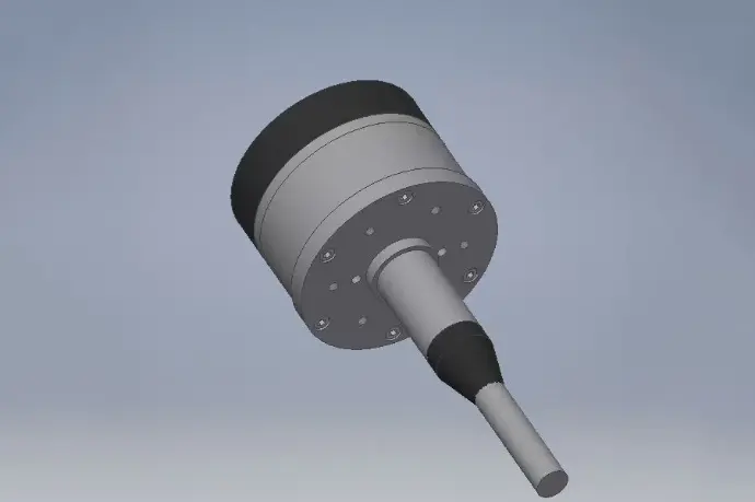
Explore the DVL-Phased Series
The DVL‑Phased Series includes the versatile DVL‑600K-phased (600 kHz) model for mid‑range missions, the long‑range DVL‑300K-phased (300 kHz) model for deep‑sea operations, and the ultra‑long‑range DVL‑150K-phased (150 kHz) model for ultra‑long‑range deep‑water deployments. Whether for coastal trials, ocean monitoring, or deep‑water engineering and system integration, the DVL‑Phased Series delivers accurate, stable, and reliable underwater velocity and navigation performance powered by phased‑array beamforming and advanced bottom‑tracking capability.