Home | DVL Series | DVL-600K
DVL-600K
Piston-type 4-Beam Doppler Velocity Log 600kHz
The DVL‑600K Doppler Velocity Log measures high‑precision motion velocity of the platform relative to the seabed. When integrated with a gyrocompass or inertial navigation system (INS), it forms an autonomous navigation system for control and high‑accuracy navigation of surface vessels, underwater tow‑bodies, AUVs and UUVs.
Tailored for compact lightweight underwater vehicles, it is optimized for water depths up to 100 m and near‑bottom precision operations. It delivers steady bottom‑lock performance for close‑seabed inspection tasks on small‑form‑factor subsea platforms.
The device supports an optional current‑profiling function to measure flow‑field profiles in the surrounding area. It enables underway observation along the carrier’s navigation track, as well as fixed‑point flow‑field observation deployed on submersible moorings and buoys.
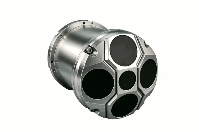
DVL-600K Doppler Velocity Log
Key Features
- 4‑beam Janus acoustic array (5‑beam optional, this page focus on 4‑beam version)
- Dual‑grade velocity accuracy: ±0.3%V ±0.3 cm/s (export‑controlled), >1% (license‑free)
- Low minimum bottom‑tracking altitude: 0.5 m, stable performance in close‑to‑seabed missions
- Optional intermediate depth‑sounding channel @400 kHz
- Ethernet + multi‑serial ports (RS232 / RS422 / RS485); PD6 & caustom data output
- Smaller dimension & lighter weight vs DVL‑300K; average power consumption only 8 W
- Multiple depth‑rating options: 100 m (standard), 300 m /1000 m /3000 m (optional)
- Dual‑purpose: underwater vehicle navigation and ocean current profile observation for buoy & mooring systems
Overview
Specifications
Applications
Core strength: higher measurement accuracy, smaller minimum blanking altitude, compact size; best fit for missions where off‑bottom height is within 100 m, especially frequent near‑seabed operation.
- Inspection‑class ROV & mid‑size AUV near‑bottom survey
Subsea infrastructure inspection: offshore wind foundation, subsea cable, pipeline visual check. Require stable navigation while vehicle flies close to seabed (0.5 m‑tens‑meters altitude). - UUV / compact underwater vehicle with limited installation space
Smaller diameter and lighter weight reduce payload burden for compact subsea platforms. - Harbor, reservoir, coastal engineering underwater operation
Typical working altitude well within 100 m max bottom‑tracking range; high velocity accuracy improves station‑keeping performance. - Oceanographic mooring & buoy current profiling
Activate ADCP function for fixed‑point flow‑field observation on buoys or submerged mooring stations. - Underwater tow‑body near‑bottom mapping survey in coastal waters
Not recommended: long‑term operation above >100 m altitude, will risk losing bottom‑lock. For large‑altitude cruising scenario, select DVL‑300K 4‑beam DVL.
Working Principle
Adopts 4‑beam Janus‑configuration Doppler acoustic measurement. Four tilted beams transmit acoustic pulses; Doppler shift of seabed echoes computes 3‑axis velocity and altitude above seafloor. When bottom‑lock is out of range, water‑tracking mode gives velocity relative to water column as fallback navigation source. Output velocity data is fused with inertial navigation system for subsea dead‑reckoning positioning.
Integration Notes
- Output velocity & altitude data can feed INS/AHRS to construct complete underwater positioning solution.
- PD6 protocol compatible with mainstream marine survey software; custom data format available for customer‑specific secondary integration.
- Wide DC input (11‑32 V) adapts battery‑powered underwater vehicles.
- Please specify target depth rating and accuracy grade (export‑controlled / license‑free) during technical inquiry.
A: DVL‑600‑1 can track bottom as close as 0.5 m above seabed, with smaller size & lighter weight and higher export‑controlled accuracy (±0.3%V ±0.3 cm/s).
DVL‑300K supports up to 250 m altitude with export‑controlled accuracy ±0.5%V ±0.5 cm/s. Both share same depth‑rating options and dual‑accuracy‑grade configuration.
A: Yes, 5‑beam is optional; this page describes standard 4‑beam configuration. Contact sales for 5‑beam datasheet.
A: Standard depth rating is 100 m; optional pressure housing for 300 m,1000 m,3000 m operating depth. Mention your working depth in your request.
A: Export‑controlled grade achieves ±0.3%V ±0.3 cm/s accuracy and needs export authorization. License‑free grade has velocity accuracy >1% for general‑purpose deployment without special export license.
A: Yes. It supports water‑track mode as a backup navigation source when bottom‑lock is lost. It measures platform velocity relative to the water column for dead‑reckoning.
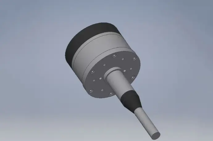
Explore the DVL-Phased Series
The DVL‑Phased Series includes the versatile DVL‑600K-phased (600 kHz) model for mid‑range missions, the long‑range DVL‑300K-phased (300 kHz) model for deep‑sea operations, and the ultra‑long‑range DVL‑150K-phased (150 kHz) model for ultra‑long‑range deep‑water deployments. Whether for coastal trials, ocean monitoring, or deep‑water engineering and system integration, the DVL‑Phased Series delivers accurate, stable, and reliable underwater velocity and navigation performance powered by phased‑array beamforming and advanced bottom‑tracking capability.